CMAR played a leading role in developing Nova Scotia’s Coastal Classification System (CCS) — a science-based, non-regulatory planning tool designed to support informed and transparent decisions around aquaculture development for finfish and shellfish.
Developed using existing province-wide data, the CCS helps identify areas along Nova Scotia’s coast where environmental, regulatory, and human-use factors may either support or challenge the feasibility of aquaculture. It’s designed to guide early-stage conversations and provide useful spatial context for industry, regulators, and communities alike.
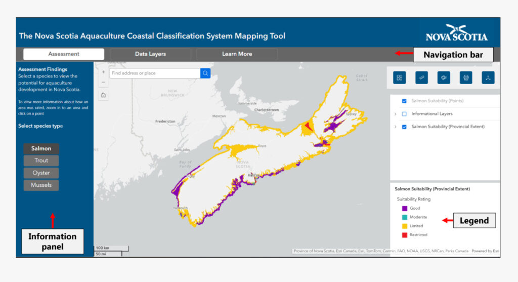
The outcome of the CCS is a publicly accessible online mapping tool, offering a visual overview of coastal suitability across the province. It’s an important resource for identifying potential opportunities and limitations in aquaculture planning.
CMAR led the scientific development of the CCS — from conducting suitability assessments to building the interactive tool.
Use the links below to access the mapping tool, view the Story Map that contains more information on the project and how to use the tool, and the final summary report.